2018 Hawaiian Volcano
Map of Flows March-June
Kilauea Summit Eruption
Kilauea Lava Fissure 8 And Lava Flow June 6, 2018
What I found on Mt. St. Helens 37 years after the eruption
| int_reader_study_guides_12.pdf |
| int_reader_study_guides.pdf |
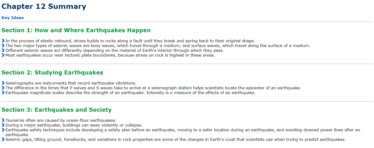
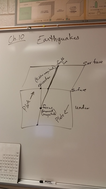
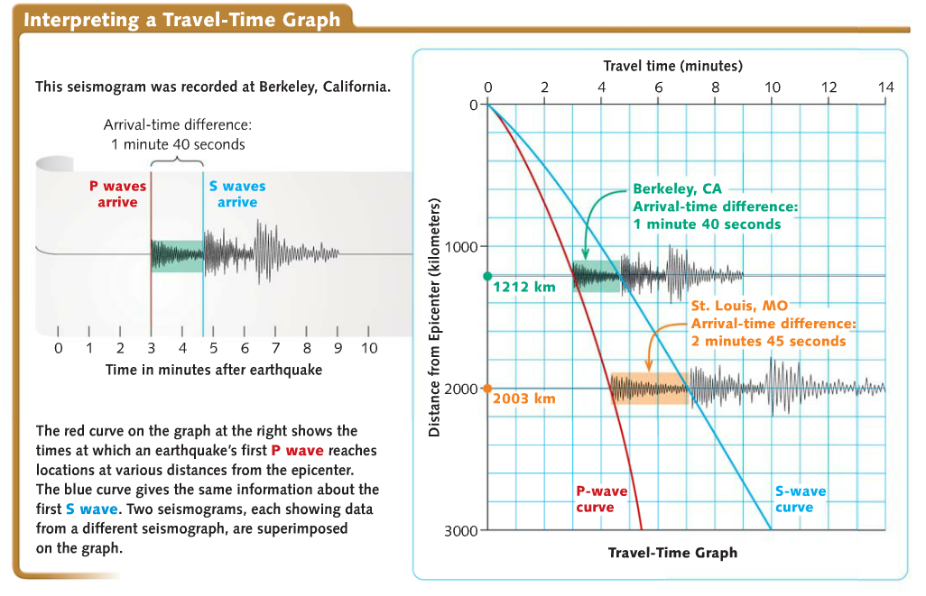
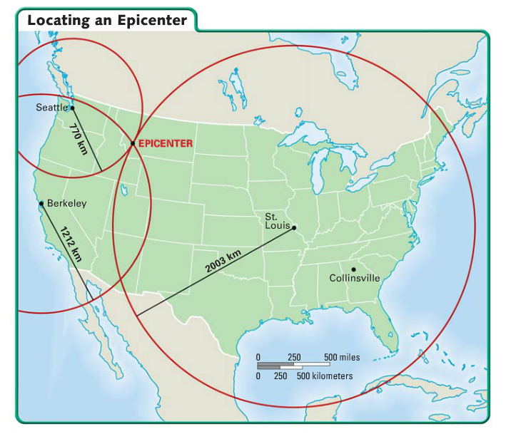
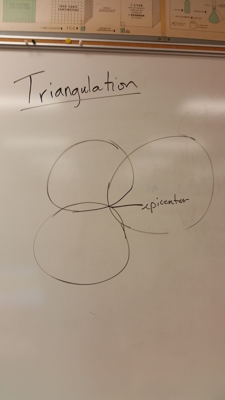
Chapter 12 Earthquakes
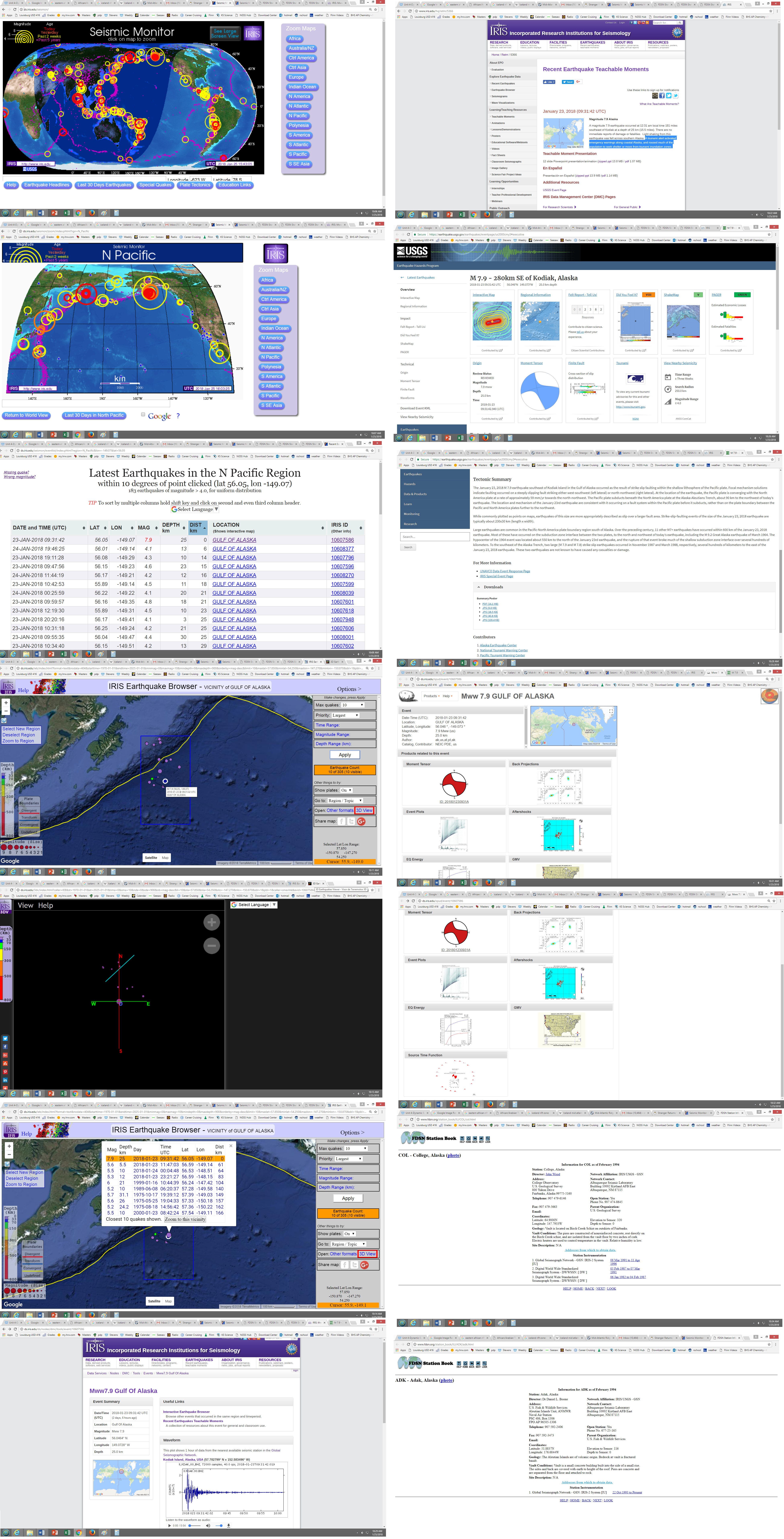
Alaska Earthquake Seismic Monitor Website
Images |
Audio |
Aftershocks Video |
|
|
| ||||||
Earthquake Depth and Volcanoes Video |
Seismic Waves Throughout the U.S. |
Powerpoint |
|
|
| ||||||
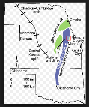
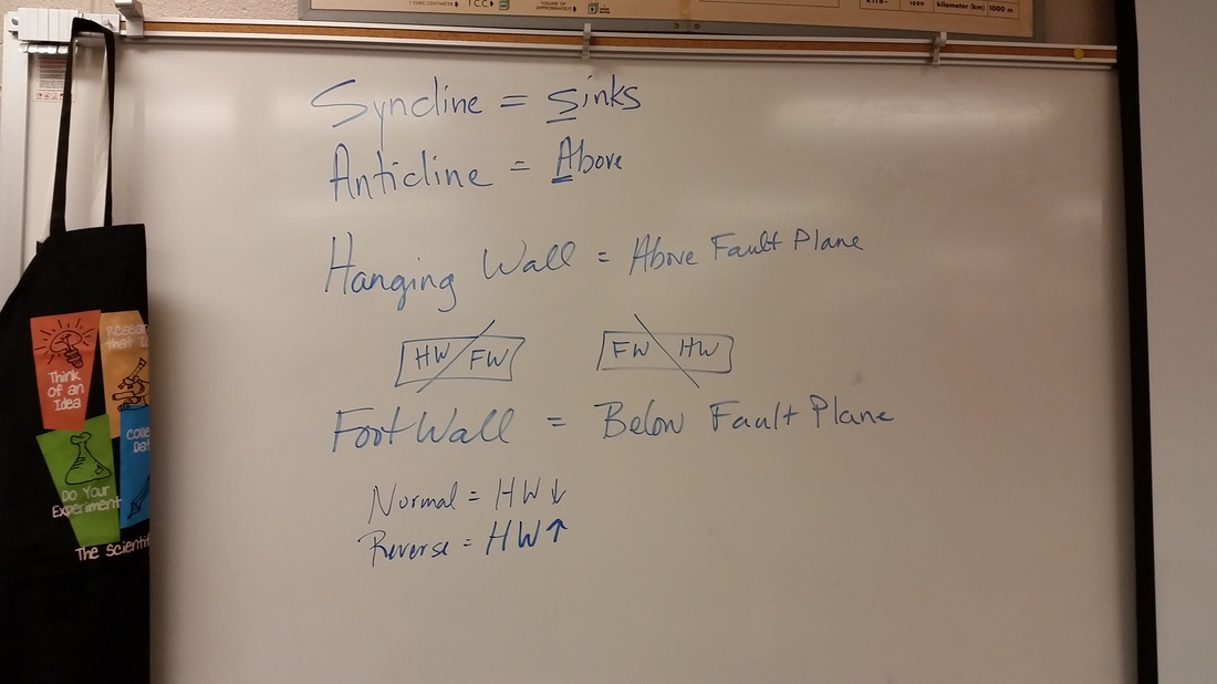
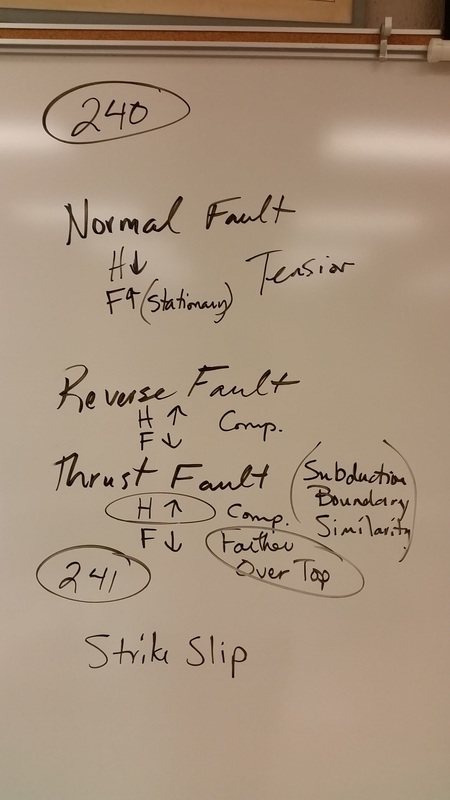
Fault Lines in KS Website
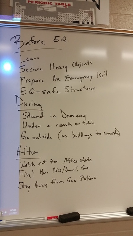
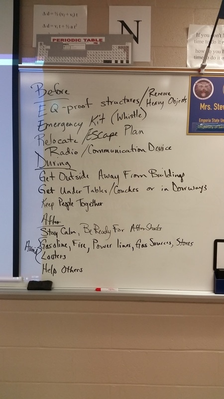
This is what you should be doing on Tuesday, February 28.
Last time we finished watching the Sumatra video. Today you need to do the following activities and watch the following videos and make sure you are ready for an earthquakes and tsunamis quiz on Thursday.
Get two partners.
Open one email to me and your partners. Use the link below to answer the following questions:
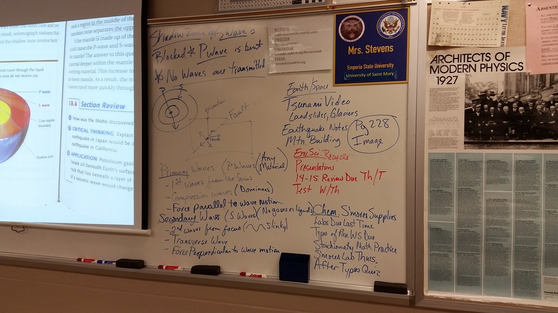
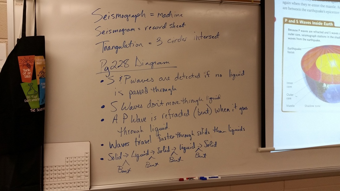
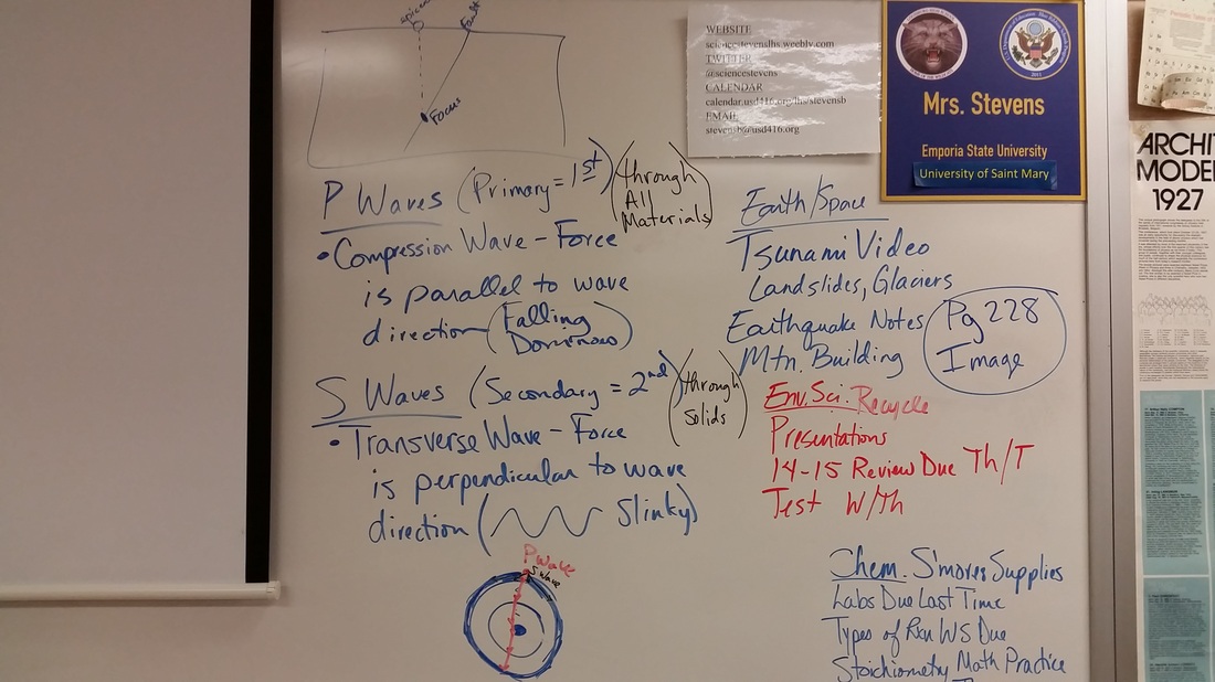
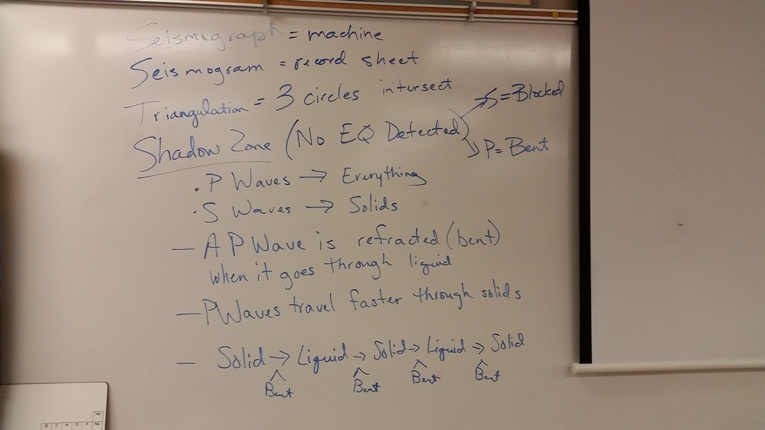
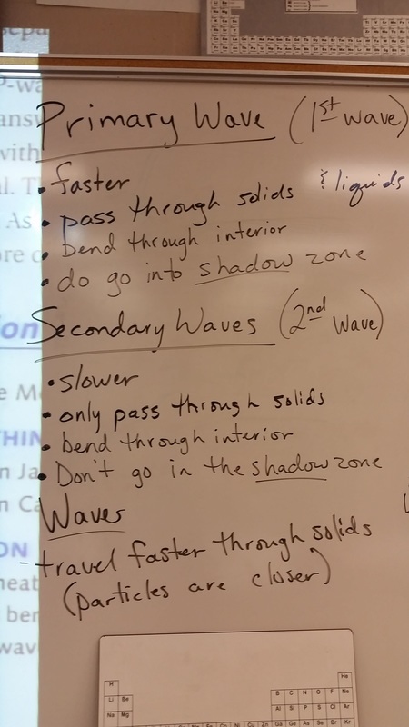
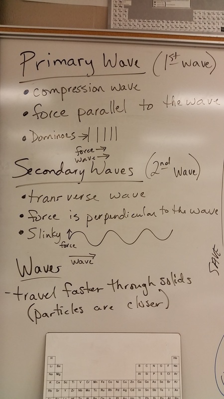
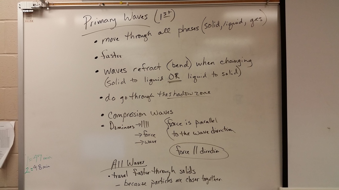
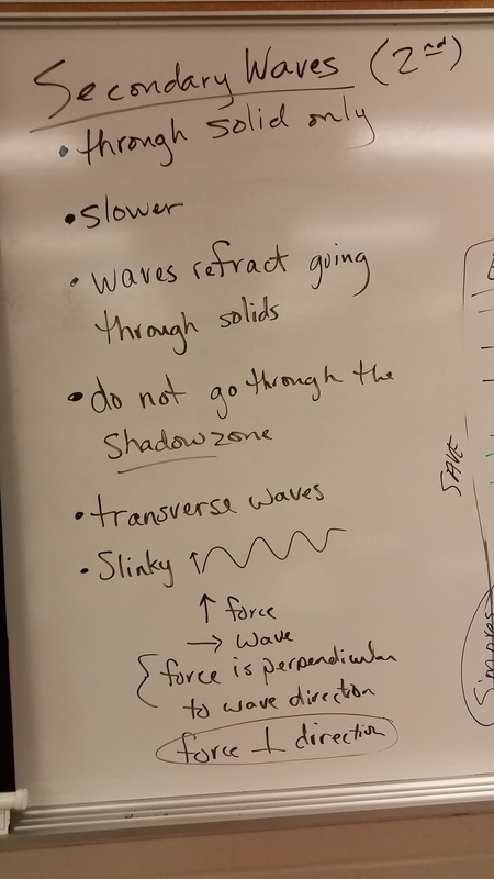
S and P waves prove what is inside the Earth.
1. Which wave starts first?
2. Which is faster?
3. What happened to the P wave when it went into the new color? (the orange layer)
4. What happened to the S wave in the orange?
5. What happened to eh the P wave in the yellow layer?
6. Why?
7. Use your book to find out what the shadow zone is. Describe it using the colors of the layers and the colors of the P and S waves.
Send the email.
*An elementary school in Washington has built a tsunami resistant school.
Discuss as a class why this is important on the west coast of the United States.
Watch this video. It is a wave at sea.
Watch this video. What is calving?
What will happen if this is a much bigger chunk of ice and if this is a much bigger body of water?
Give 2 answers for each.
This is all on this website for today. Make sure you are ready for a quiz on Wednesday.
We are going to watch San Andreas. It is in the computer already.
No one can go to the restroom during the movie.
Please write down the time where you stop.
Do the Ch. 12 and 13 Vocab using the vocab sheet provided.
| vocab_guide_1.doc |
| ch.10_earthquakenotes.docx |
Ancient Japanese Buildings Withstand Earthquakes. Why?
In Class: Watch Forces of Nature Video from 15 min. to 25 min.
1989 World Series Oakland A's vs. San Francisco Giants
Bay Bridge Construction and Repair
The western section is a double suspension bridge with two decks, westbound traffic being carried on the upper deck while eastbound is carried on the lower one. The largest span of the original eastern section was a cantilever bridge. During the 1989 Loma Prieta earthquake, a portion of the eastern section's upper deck collapsed onto the lower deck and the bridge was closed for a month. Reconstruction of the eastern section of the bridge as a causeway connected to a self-anchored suspension bridge began in 2002; the new eastern section opened September 2, 2013, at a reported cost of over $6.5 billion, a 2,500% cost overrun from the original estimate of $250 million.[9][10]Unlike the western section and the original eastern section of the bridge, the new eastern section is a single deck with the eastbound and westbound lanes on each side making it the world's widest bridge, according to Guinness World Records,[11] as of 2014. Demolition of the old east span was completed on September 8, 2018.[12]
1989 Footage
Nimitz Freeway Damage and Repair
Modern history[edit]
Cypress Viaduct and the 1989 Loma Prieta earthquake[edit]
Portion of the collapsed Cypress Viaduct in Oakland. A large double-decker section in Oakland, known as the Cypress Street Viaduct, collapsed during the 1989 Loma Prieta earthquake, causing 42 deaths; initial estimates were significantly higher, but because many commuters on both sides of the bay had left early or stayed late to watch Game 3 of the San Francisco-Oakland World Series, the freeway was far less crowded than normal at the time of the quake.[27] This was the greatest loss of life caused by that earthquake. Rebuilding the affected section of the freeway took nearly a decade, due to environmental impact concerns, the feeling that the freeway divided the neighborhood, design considerations and most importantly a huge outcry from the West Oakland community demanding that the freeway find a new route - not in West Oakland. The protest was successful. The freeway reopened in July 1997 on a new route parallel to railroad tracks around the outskirts of West Oakland with the entire project being opened in 1999 and fully completed in 2001. Although only about three miles (5 km) in length, the replacement freeway cost over $1.2 billion, for several reasons: it crossed over and under the elevated BART line to San Francisco; it squeezed between a post office, the West Oakland BART station, the Port of Oakland, a rail yard, and an East Bay Municipal Utility District sewage treatment plant; it occupied an entirely new right-of-way, which required the acquisition of large amounts of valuable industrial real estate near the Port of Oakland; and of course, it had to be earthquake resistant.[28] The former path of the structure, Cypress Street, was renamed Mandela Parkway, and the median where the freeway stood became a landscaped linear park.[29]
Nimitz Freeway Construction Research and Re-engineering
www.umsl.edu/~feldmanb/pdfs/Nimitz_Freeway.pdf
S and P waves prove what is inside the Earth.
*An elementary school in Washington has built a tsunami resistant school.
*First tsunami-proof building to be built in Westport
Japan Tsunami Caught On Tape | BBC Natural Disasters & Weather Documentary 2016
3/11/2011 Japan's Earthquake and Tsunami
2:00 Water starts coming in
Tsunami Wave at sea: Japan's Coast Guard
Aerial Footage in Japan
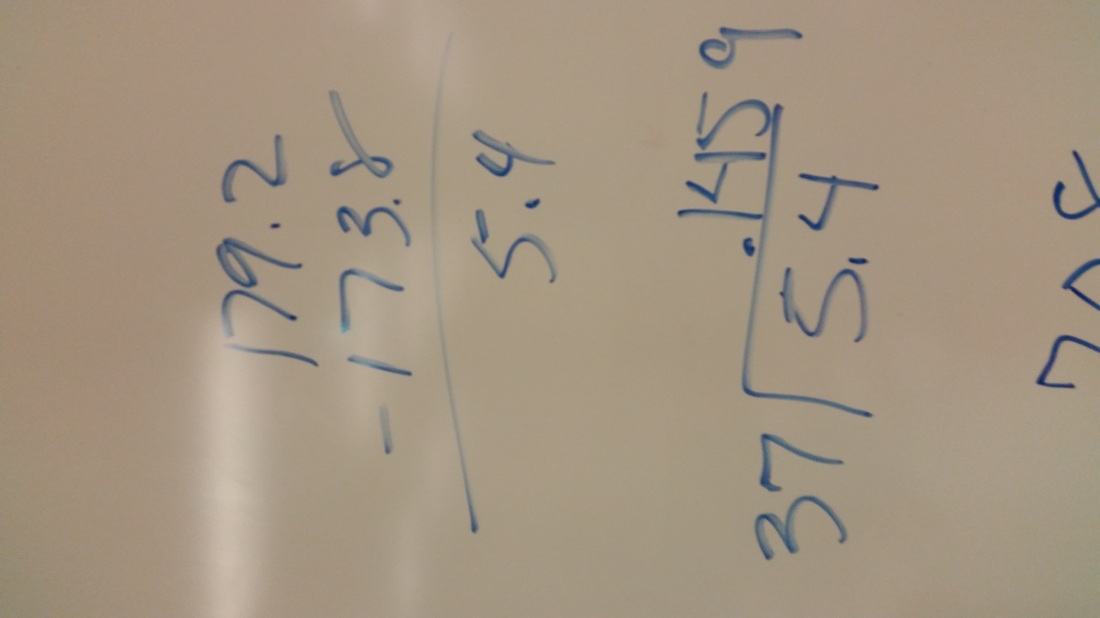
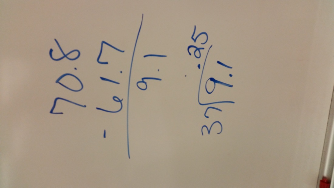
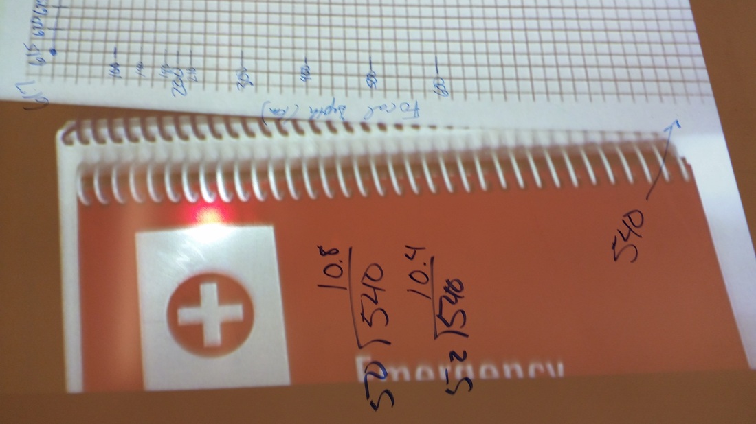
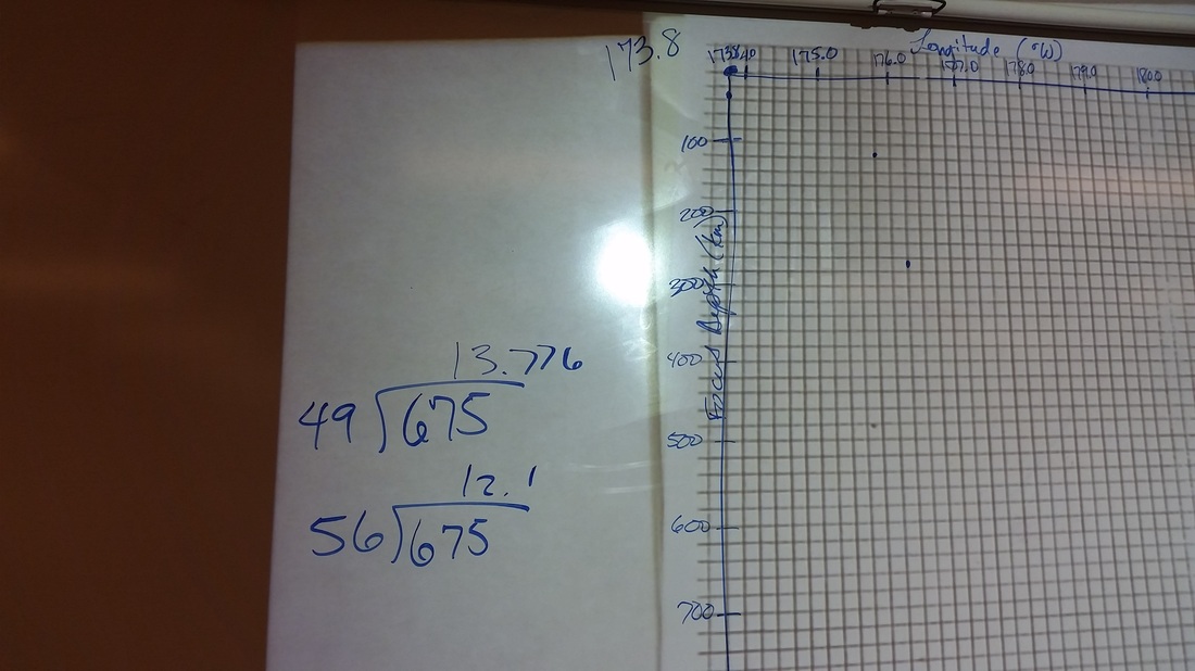
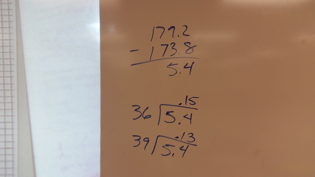
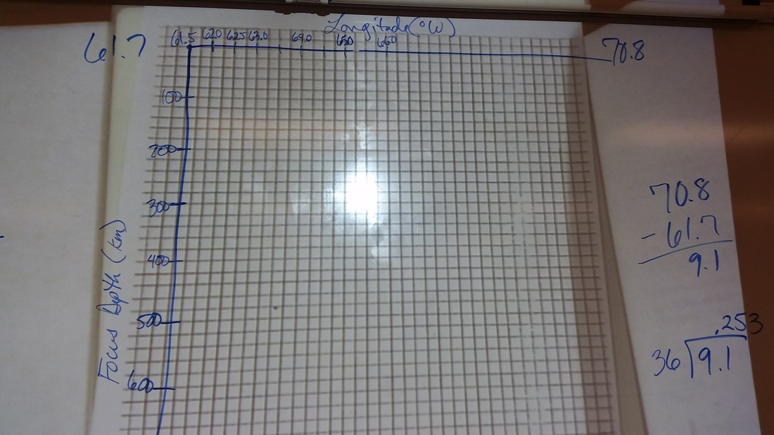
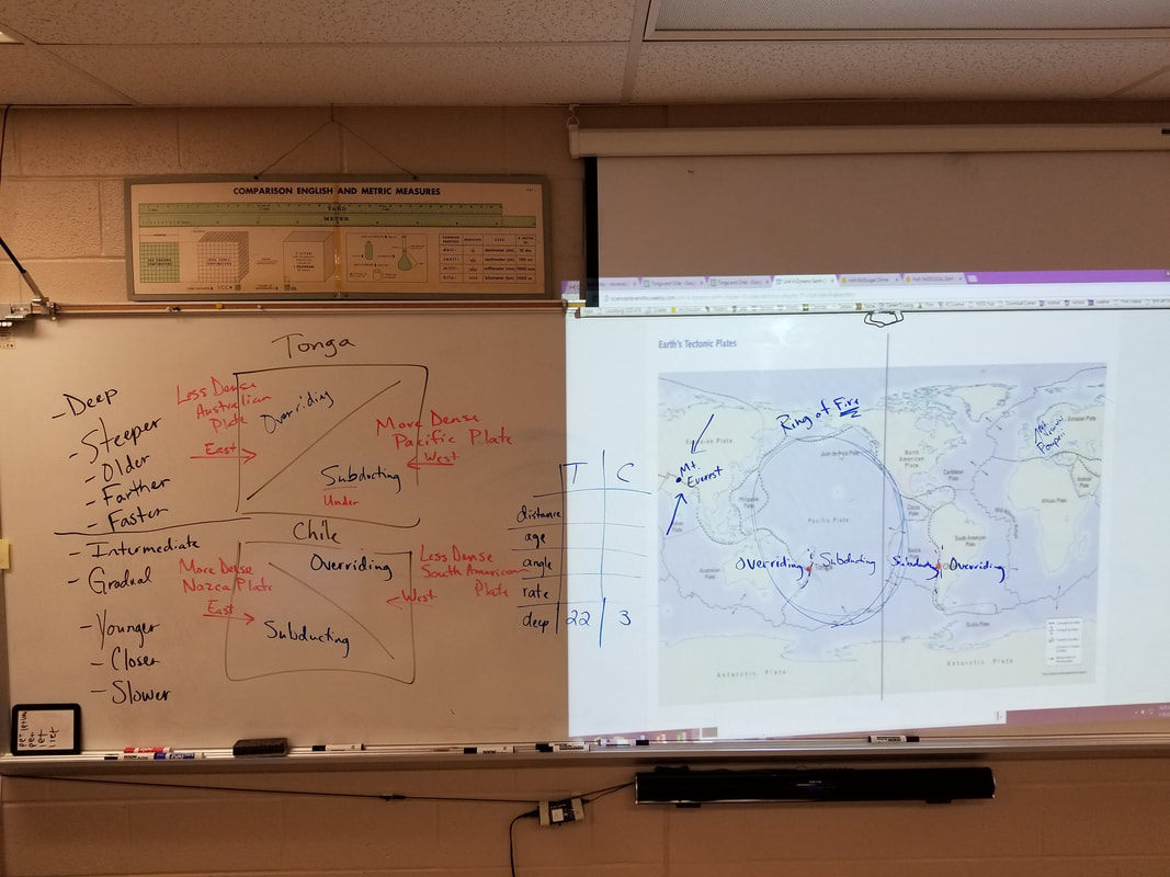
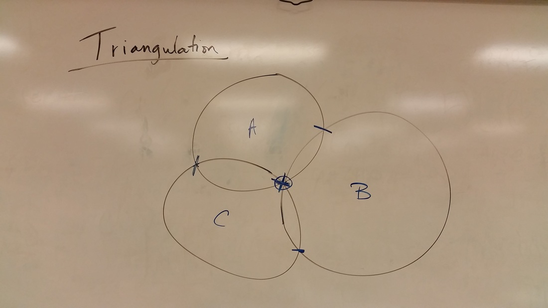
Graphing Lab--How does the Pacific Plate determine where the earthquakes are?
| 10_earthquake_graph.pdf |
First Block Graph
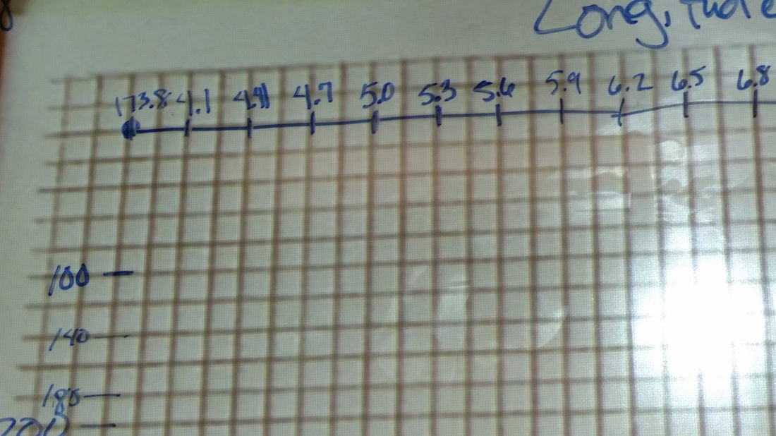
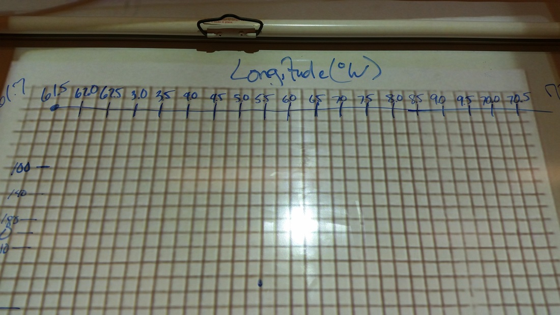
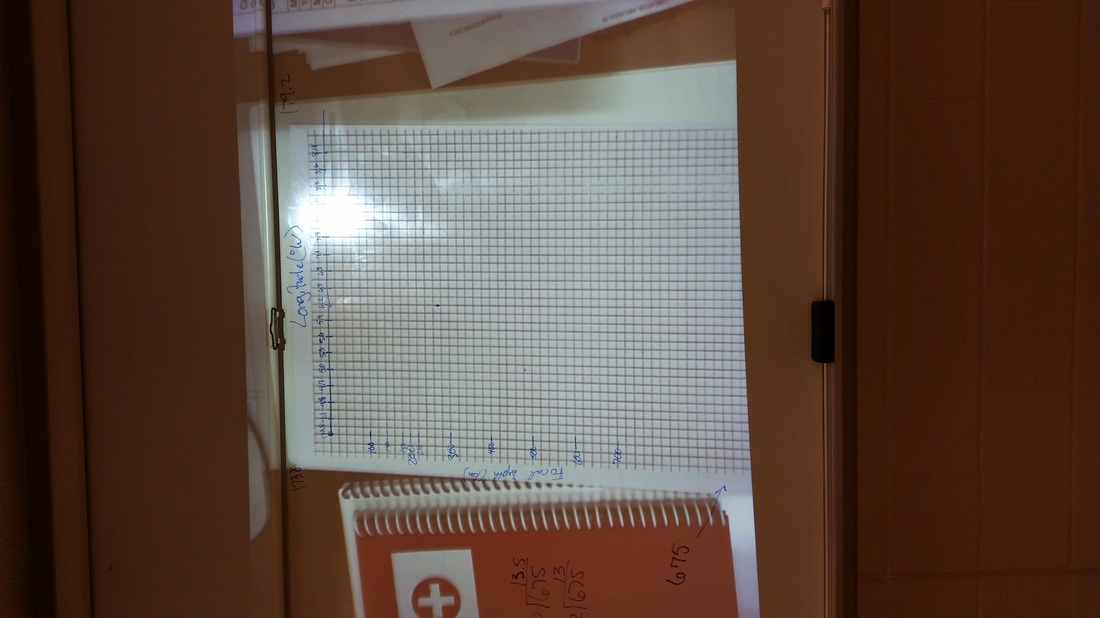
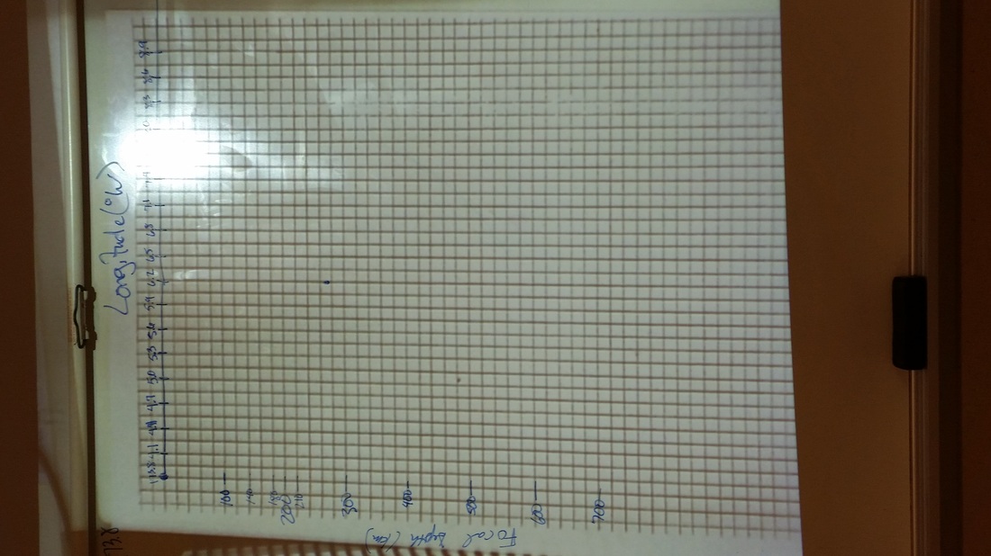
Sixth Block Graph
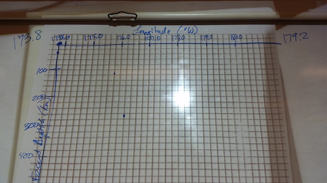
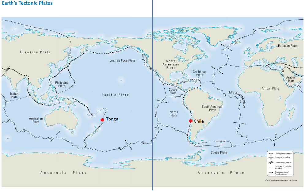
Pg. 712 and 713
| tonga_pg_712_713.png |

Pg. 710 and 711
| tonga_pg_710_711.png |

Tsunami Documentary
Wave That Shook The World - tsunami documentary
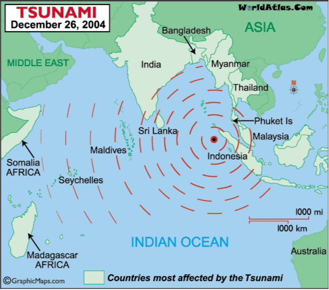
*Indian Ocean Tsunami Information Center
*After the devastation: recovery.
Causes of Tsunamis:
1. Earthquakes
2. Asteroids
3. Volcanic Eruptions
4. Landslides (either underwater or above water)
5. Glaciers Calving
Lituya Bay, Alaska, July 9, 1958
1720 ft.
Lake Geneva Landslide
1st Block Notes
6th Block Notes
2016 Notes
Last Day of Notes
Italian Alps Rock Climbing Video--Fault Block Mountains
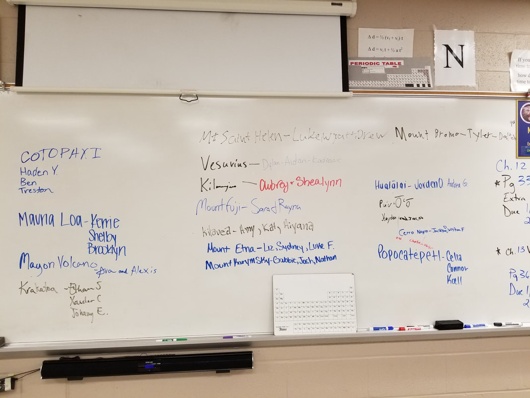
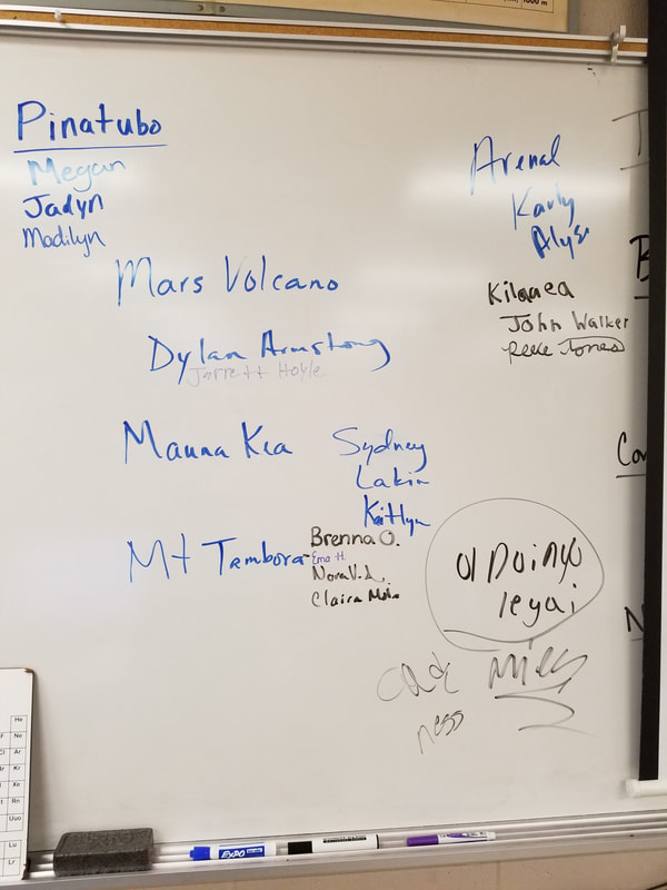
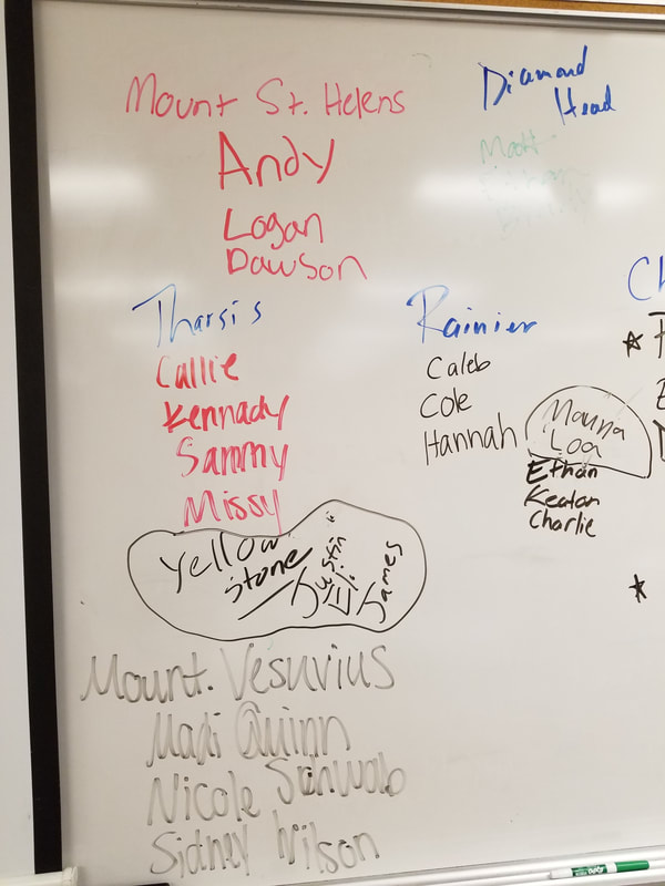
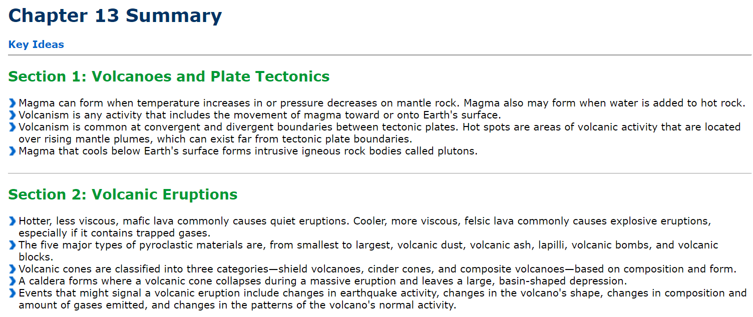
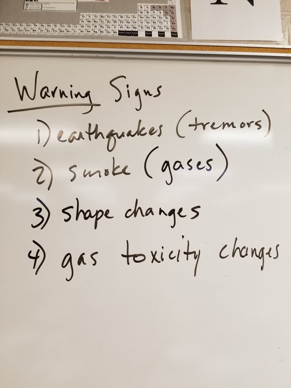
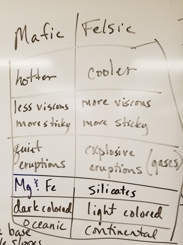
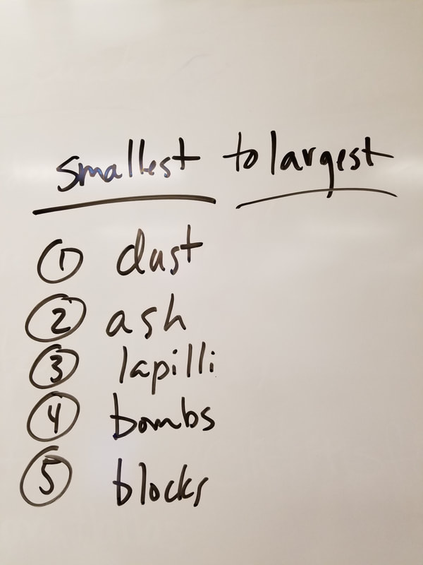
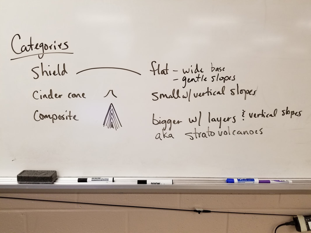
Chapter 13 Volcanoes
